Glacier Bay, Alaska 2007
All was silent. Suddenly there was the sound of shingle crunching as something large bounded towards our tent. We were lying in our tent at dusk, sleeping bags zipped up to our necks, our pepper spray in tent pockets inches from our slug like forms. Debbie who had an ear-plug in startled and said
What’s that, is it a bear?
Shhhhh, I whispered. By now it was panting heavily as it slowly circled around the edge of our tent taking in all our scents. The books had warned that you must not store scented items like food, toothpaste or deodorant in your tent as it will attract bears. We had followed the rules, but after 14 days of not washing, our tent must have been oozing scent. Careful not to startle it I thought, if it jumps on the tent at this moment we’re in trouble. What if it trips on the tent guy lines? If only I could get my hand out to get my pepper spray, I squirmed quietly. Before I could manage it, the bear bounded off.
Dawn and dusk are when brown bears are most active. We had read about how to camp in bear country, which all made sense at the time. What they don’t tell you is that when you go into your tent to go to sleep, you stop “defending your camp” and the space around your tent becomes bear-space. I never slept until it became properly dark. I kept reminding myself that bears tend not to attack people. Indeed, statistically, one has a greater chance of being killed by a dog than a bear. Debbie said.
think of them like large dogs……… next time we’ll bring some dog-food
she joked. I could sort of relate to that, except that adult brown bears weigh between 220 and 1,400 pounds. Brown bears and grizzly bears are generally considered closely related sub-species. Brown bears are coastal dwellers and are typically much larger than grizzly bears.

Young brown bears, Glacier Bay
At the start of our holiday, on the flight from Seattle to Juneau, a hunter tried to reassure us (we think) that the bears wouldn’t trouble us by saying that at this time of year, they’d be grazing on the sedge meadows at the top of the beaches. This didn’t reassure us at all, as this is where we knew we’d be camping. This proved to be correct.
A couple of days before our dusk bear visit, we had our first encounter with brown bears whilst cooking. We were at the top of Tarr inlet, where we were camped in a bay with a big inter-tidal beach. The beach was a mixture of rocks, mud and seaweed. Behind the beach was a fringe of sedge meadow; which in turn was fringed by alder thicket. The normal signs of bear activity were also present; trails through the sedge, bear skat and even belly holes. As had become routine, I was yodeling and singing to the bears to make them aware of our presence. We had set up camp towards one side of the bay and as the light started to fade, we took our food and cooking equipment into the inter-tidal zone to cook. It was half-tide, so to get far enough away from our tent we moved around the bay. Our food was simmering nicely with the MSR stove roaring reassuringly. As I tended the stove, Debbie mixed up an expensive “expedition dessert” which we had bought at the National Park shop.
Oh my god
Debbie quietly and slowly exclaimed in disbelief. I had seen it too, but reality was still sinking in. Across the bay, perhaps 200 yards away, a large brown bear was clambering out of the river and slowly moving along the top of the beach in our direction. It was the largest we’d seen. He was a striking champagne blonde colour, his shoulders rolling as he slowly swaggered along. He didn’t seem to know that we were there. He had come from the direction of a large waterfall which had probably drowned out my singing and yodeling. He seemed to be out on his dusk beach patrol. The procedures in the books kicked in: The bear proof canister was locked and we both stood up and started speaking loudly to the bear (without sounding aggressive) to make him aware of our presence:
Hello Mr Bear, it’s okay we’re just visiting your beach
explained Debbie. I sung:
Oh Mr Bear, oh Mr Bear how big and furry are you
(to the tune of Oh Christmas tree!)
We gently waved our arms. He stopped and “stood up” onto his rear quarters. He had a dirty brown under-belly. This didn’t alarm us as we knew he was simply sniffing the air and trying to get a better view of the commotion in front of him. He dropped onto all fours again and proceeded towards us as before (this started to alarm us). He now knew we were there and yet he continued to approach. We decided to ratchet up our behaviour. We became louder, Debbie ushered me onto a small flat rock to increase my stature and she became the percussion section, with the pot lid and a spoon. She reminded me:
Don’t look directly at him.
The safety clips on our pepper sprays were removed at this point.
If he charges don’t move.
It was a game of nerve. Most brown bear charges are not followed through; with the bear changing direction at the last-minute. Sometimes they can charge several times. Suddenly, he broke into an unconvincing bounding run, but with only a slight change in direction, and disappeared into the alder thicket (behind our tent).
Is it over? Has he gone?
Bears have been known to circle and approach from a different direction. The chocolate mouse was setting nicely, so we gulped it down. The hamburger helper (without the hamburger) was still only half-cooked. We tossed it into the sea, washed the dishes and gingerly made our way up the beach and went to bed hungry.
The next morning we decided on a hearty breakfast of pancakes. We rationalised that the champagne blonde now knew we were there and would stay away. It was low tide and we were therefore cooking well down the beach. Just after Debbie had poured the first pancake on the pan, a different, much smaller cinnamon coloured brown bear approached from the same direction. This one was less than half the size of champagne blonde. We started our procedure to alert the bear to our presence. We got the impression it was an older female. We were much further down the beach than the previous night. It became apparent that the bear was aware of us, and it became clear that she simply wanted to pass along the top of the beach. We stopped and waited. She walked passed our kayaks and tent and found her favoured belly hole, a few yards from our kayaks, and climbed in. We resumed cooking. A bald eagle landed on a small grounded iceberg on the beach. At that point, a small cruise ship appeared around the headland.
I’m starving, we’re eating no-matter what.
Debbie exclaimed defiantly. When you spend time with nature, you learn that animals are constantly watching each other. They find their place together in a sort of dynamic harmony. Debbie joked that cinnamon bear perhaps had joined us for breakfast. After ten minutes or so, the cinnamon bear lazily got up and sauntered back towards the waterfall.
We were on expedition paddling from Juneau into Glacier Bay National Park. It took us 6 and a bit days to get to the Park. We paddled daily for 18 days, covering a total of 360km and camping wild as we travelled. We came across 11 brown bears on our journey, and footprints, trails, belly holes and skat of many others. Seeing them on the shore as we paddled was exhilarating. En-route to Glacier Bay, we camped on Admiralty Island which has the highest population density of brown bears in the world.
Below is a chronological photo-journey of our expedition:
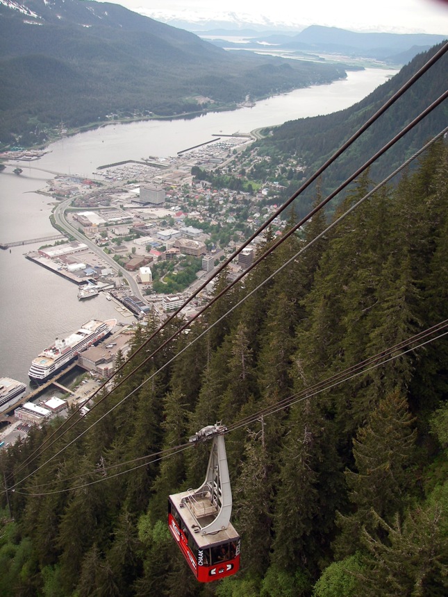
Juneau
The US is great for shopping. We had a day and a half in Juneau to buy three weeks worth of food; coleman fuel; MSR fuel bottles; some rope to hang food; pepper spray for bears; and ideally some pyrotechnic flares. We achieved all of this with an afternoon to spare and done some sight-seeing.


.
Gastineau Channel
The next morning we carried everything from our hotel to a nearby boat ramp. This took several journeys and was the most tiring part of the trip. The next task was building our kayaks before packing all our food, camping kit and clothes inside. We finally set-off early afternoon, just in time to catch the tide northwards through the Gastineau Channel.
We had planned a shorter first day camping with the intention of camping at an organised camp ground within a recreation area at Point Louisa on the map. The camp ground did not appear to exist and it was getting dark so we ended up camping somewhere we were not supposed to. We however left no trace and did not feed the bears!

.


Packed and ready to launch

Gastineau Channel


.
Admiralty Island
The next day was sunny and bright with light winds. Our plan was to paddle to Admiralty Island where we’d ideally camp on the west side ready for an early morning crossing of Lynn Canal the next day. As we passed the lighthouse at the northern tip the keeper was fishing and greeted us excitedly. He seemed keen for us to land, and the possibility of being fed and watered was very tempting, but we soldiered on to find somewhere to camp on the west side. As we worked our way down the west side of the island, we saw our first brown bear grazing on the sedge meadow between the rocky shore and the forest edge. It bounded into the under-growth when it saw us. We were however stopping to camp soon. This was our first truly wild camp and it was to be on Admiralty Island, with the highest brown bear density in the world.
As Debbie was sorting out the inside of the tent, I went into the forest to hang three weeks worth of food. The trees were all middle aged spruce with very limited side branches lower in the crowns. The floor of the forest consisted of spruce needles and a dwarf shrub layer which had been heavily grazed. The forest smelled of large smelly animal, similar to being next to fox’s den. I tried throwing my rope into the trees. The branches just didn’t seem strong enough. There is clearly a knack to this hanging of food business. I was becoming freaked by the smell and the obvious presence of animals and returned to camp looking rather pale. We stashed our dry bags in a rock crevice and covered them with rotting seaweed. As we watched the sun set over Lynn Canal a procession of humpback whales and porpoises passed close to shore.


Shortly before we camped on Admiralty Island we spotted our first Brown Bear

On guard, Admiralty Island

Lynn Canal

Admiralty Island
Lynn Canal
The successful crossing of Lynn Canal would be one of the bigger events in our schedule. Delays at this point could curtail the extent to which we could explore Glacier Bay later in the trip. Lynn Canal is a wide and long strait which becomes Chatham Strait to the south west. Together they connect Haines to the open ocean around 380km to the south. It was an important route for both cruise ships and humpback whales. From maps, we knew that it had the capacity to funnel wind and waves. We aimed to cross at one of the narrower points where it is 8km wide. In good conditions, this should be possible in around two hours.
As we left our beach, the sky was blanketed with a dark layer of alto-status. After a few minutes we passed a small headland that had been providing shelter. There was a steady force 3 blowing from the south-west. The waves were bigger than we’d have expected with fairly light winds. In order to prevent ourselves being washed north-eastwards we set our bows slightly into the wind. The wind steadily increased as we crossed and by the time we reached the other side it was a strong force 4. As we worked our way south along the coast, the wind was now touching force 5 and we decided that we were expending a lot of effort for not a lot of gain. We landed and set-up camp as it started to rain.
Writing this in 2013, I now realise that all the signs of deteriorating conditions were there when we set off. In good weather wind often comes and goes. In deteriorating conditions it can be a constant light wind before it steadily increases. Also, waves can precede approaching wind. The heavy skies completed the story.

Lynn Canal

Crossing Linne Canal


Our food is stashed (in dry bags) under this scented pile
Icy Strait
The next morning, we packed and set off in the rain. Packing or setting up camp in the rain is pretty miserable, but once on the water the rain doesn’t matter. The raindrops on the flat sea and the tiny ripples from each were mesmerising. As we turned the corner from Lynn Canal into Icy Strait, we cut behind Couverden and Anstey Islands. Behind the islands, the water was shallow and the shores muddy. Remarkably, despite it being shallow, a humpback whale had chosen a similar route and was moving through in the opposite direction.
We needed to fill our water bladders and there was a small river on our charts. After pulling our kayaks up the beach, we noticed a small house set several hundred metres up the river; a fishing boat was moored in the sheltered bay and a zodiac was pulled up on the beach. A house upstream was bad news in terms of being sure the water was safe to drink. At that point, the householder pulled up on a quad-bike and realising our quest for water, promptly whisked our bladders on his quad to fill them for us at the house. Upon his return, he was keen to show us how he gathered cockles from the mud, but warned us not to eat the mussels as warnings of paralytic shellfish poisoning had been issued. He lamented that the bears were a nuisance as one had destroyed a zodiac (it probably smelled of fish). Hopefully our fragile skin on frame kayaks would not succumb to a similar fate.
We had always believed that Glacier Bay National Park would be the highlight of our trip and arriving with sufficient time to explore and enjoy was always driving us forward. Icy Strait is however stunning: A wide and open Strait, with a strong sense of the nearby ocean. The shores are fringed with sedge meadows. Behind this a narrow band of emerald green alder thicket gave way to the dark green climax forest of spruce and hemlock. As the ground rose, the forest gave way to rugged snow covered mountains. The tidal race at Point Adolphis at the western end of Icy Strait is famous for its congregations of humpback whales. There was a regular procession of whales making their way along the Strait.
The sky cleared, the sea and the snowy mountains sparkled in the sun as we travelled with the whales through the Strait. Invisible droplets in the air sparkled like magical fairy dust over the sparkling turquoise sea. We camped in an open bay overlooking the expanse of Icy Strait. At the other end of the bay, a few kilometres away there was a small cabin. After we had set up camp a float plane circled before landing and being met by a small boat to collect the passenger. The plane was back in the air within minutes and soon everything fell quiet again. We had seen a number of float planes on our journey. They flew relatively slowly and between mountains, navigating like kayakers, following waterways, bur sometimes taking short-cuts across low-lying islands. It seemed that their massive floats made them awkward in the sky but perfectly adapted to remote Alaskan life, sort of Land Rovers of the sky. I wanted one!
The next morning was bright and sunny. We stopped for a break on the Porpoise Islands. These tiny perfectly formed rocky islets, with trees on top had occasional tiny shingle beaches. I was tempted to set up camp but Debbie reminded me that we needed to camp on Pleasant Island in order that the next day we could enter Glacier Bay without needing to land on the mudflats at Gustavos. That night on Pleasant Island the breeze died and it became silent. We could hear every branch and twig that snapped. It’s easier to sleep when there’s background noise to temper the imagination. After a sunny and wind free day, the musty scent of animal oozes from the forest.
As we were packing the next morning, Debbie’s barometer was dropping rapidly. It had fallen 10 millibars overnight and Debbie forecast imminent strong winds. Not wanting to risk having to attempt to camp at the Gustavus mudflats, we had a short day and set up camp towards the western end of Pleasant Island. As we set up camp, the wind started to steadily increase becoming a good force 6 by mid afternoon. Paddling with a weather forecasting geek can be useful sometimes.

The art of packing with provisions for 3 weeks


Icy Strait


Camping on Icy Strait


Porpoise Islands, Icy Strait

Small orange bear finds smelly bear den, Pleasant Island, Icy Strait

.

Glacier Bay
As we passed the mudflats at Gustavus we were glad we hadn’t needed to land or launch from there. The tide went out for miles. As we approached Glacier Bay we passed through a wee tidal race where the turquoise sea danced like a funky lemon meringue pie. Once in the National Park we started to hear float planes asking to land (on the sea) on marine VHF channel 16. I guess when they land they become shipping. We were expected to report into the National Park office at Bartlett Cove and we camped in the only proper campground in the Park. We were required to attend a bear safety lecture and collected bear proof food canisters. We were also required to provide a route itinerary. There was a small part of the Park where camping was forbidden as bears were becoming over-familiar to humans.
The hotel has a tour boat which also offers a drop-off and pick-up service to kayakers. The location of these points changes each year to reduce the risk of bears becoming over-familiar. We arranged a pick-up for 11 days time and same boat would also take us all the way back to Juneau. After spending six and a half days paddling to the Park, all these people and formality was a shock to the system. We left early next morning to catch the tide through some shallows and we later heard that on the same day, a couple of young black bears destroyed a number of tents in the campground. Sometimes it’s safer away from other people.


.
Crossing Glacier Bay
We camped on a bed of wild strawberry flowers in the Beardslee Islands. It was lightly raining and mist swirled over the islands. We awoke to thick fog. This was not great news for our 7km crossing to Willerby Island, but at least it was wind free and the sea pan flat. We set off on a bearing. In the fog every sound seems to become louder. Every drip of water from the paddle or tether tape dragging in the water grabs your attention. Shovelling water is off-course poor paddling technique and the fog re-concentrated the mind on the perfect technique. Can I paddle silently, with no drips? After a while we could hear the unearthly groaning from the stellar sea lion colony on Marble Island. These large animals can be defensive of their colony and we stayed well away. One however decided to check us out and came out investigate us. It was very large; it’s back as broad as my kayak. It was confident and bold and happy to look me in the eye. It seemed to be simply curious and playful. As we reached Willerby Island the fog was clearing but the wind was steadily increasing.
We made our way northwards past Francis Island to Drake Island. Our landing and camp on Drake Island was rugged and rocky, but with an excellent view up Glacier Bay.


Beardsley Islands

Crossing Glacier Bay

Marble Island

Stellar Sea Lion

Drake Island

Camp, Drake Island

.
Blue Mouse Cove
Glacier Bay is not what I’d classically regard as a bay. It is a long deep glacial fjord with a number of branching arms. Off this framework lie a number of small and often shallow inlets or coves, which are sometimes used as anchorages and for wildlife watching. It was a Park Ranger who suggested we camp at Blue Mouse Cove. From our camp spot, we had dramatic views of the Mount Fairweather Range. In the sheltered cove, the beach was almost entirely made up from mussel shells with wider than normal sedge meadow behind. It was sunny and warm and a good opportunity to air our kit and dry off any dampness accumulated from previous days.
We speculated why it was called Blue Mouse Cove. Was there a rare species of mouse that is found there? There was a lot of bear skat in the meadow and we decided to stay out of their way and camp at the very top of the beach. That night we discovered another reason why it may be called blue mouse. In the sheltered cove there was not the normal gentle sound of waves lapping the shore. During the night, Debbie noticed the sea very quietly creeping under our flysheet. In the darkness we hastily moved camp onto the sedge meadow. The tide rose all the way up to the edge of the meadow. The tidal range in South East Alaska is much larger than in the UK. During springs, the range can be as much as 20 feet, with the tide at night being substantially larger than during the day. Even with the information in the tide tables, we learned that the tide always come up further than you think possible.


Blue Mouse Cove


Kit drying, Blue Mouse Cove

Evening light, Blue Mouse Cove


.
John Hopkins Inlet
As we moved deeper into Glacier Bay, the temperature cooled as we got closer to glaciers. The mature climax forest of hemlock and spruce were replaced by a bright emerald green alder thicket. Alder is one of the first colonisers after the glaciers retreat. Under the thicket, thin soils start to develop. The nitrogen fixing properties of alder further improves growing conditions. With the passage of time, these thickets are colonised by spruce and later hemlock, which ultimately out compete the alder. Alder is thereafter relegated to clearings and forest edges along the shore.
After a further two days, we reach John Hopkins Inlet. We were beyond the trees. We camped on the glacial gravels with wide open views around us. With no trees, there would be no black bears (nowhere for then to escape the brown bears). This reassured me. Whilst black bears are much smaller, they are apparently much more prone to maverick behaviour and turning bad. The behaviour of brown bears was on the other hand fairly predictable. A couple of paddlers from Seattle whom we met later in the trip found this rationale strange. Whilst what I said was true, the brown bear brought with it a much greater likelihood of death or serious injury should something go wrong. I do however greatly believe that if a brown bear and I can see each other from a long way; we can avoid each other without any nasty surprises. Debbie just wished she had brought some dog food. We camped with spectacular views of the John Hopkins Glacier. Beyond this point, access was not permitted in order to protect a breeding seal colony below the glacier.
Over the last couple of days, my kayak had been steadily filling with water each day, to a point whereby I needed to stop and pump or empty it out. Feathercraft kayaks are remarkably easy to repair on extended trips. After a few failed attempts to locate and patch the likely skin puncture, we stuck a bit of gorilla tape on a seemingly inconsequential wee gouge under the bow and suddenly my kayak was bone dry.


Tonnage before paddle, John Hopkins Inlet


Lamplugh Glacier, John Hopkins Inlet


John Hopkins Glacier

Selfie, John Hopkins Inlet


Searching for the perfect camp, John Hopkins Inlet

Camp, John Hopkins Inlet

Boat repairs, John Hopkins Inlet

.
Tarr Inlet
Tarr Inlet is the most north-westerly extent of Glacier Bay. The Grand Pacific Glacier is large and wide but is a rather unremarkable brown colour. This contrasts with the appetising mint and chocolate Margerie Glacier nearby. We camped at a bay overlooking both glaciers. This is where we met both blonde bear and cinnamon bear. What we learned was that bays with rocks, seaweed and mud also have a lot of mussels and crabs, which attract bears. The top of the beach was lined with sedge meadow over glacial gravels and shingle, with alder thicket behind. This was classic bear foraging habitat. This is a place where one should expect bear patrols at dawn and dusk.


Grand Pacific Glacier, Tarr Inlet

Margerie Glacier, Tarr Inlet


Margerie and Grand Pacific Glaciers, Tarr Inlet


Margerie Glacier, Tarr Inlet

.
Mount Wright
We headed south-eastwards to meet our scheduled pick-up at Mount Wright at the entrance to John Muir Inlet. The sea in this part of Glacier Bay is a glowing turquoise as a result of all the suspended glacial sediments. Debbie thought it more likely to be due to fairy dust. After three days we were at our pick-up point (marked by a large cairn with a branch sticking out of it). We dismantled our kayaks and set up camp awaiting pick-up the next morning.
The next morning we were joined by perhaps six other paddlers in two groups. It seemed that these paddlers had been dropped off at one drop off and arranged to be picked up at the other. Fortunately for us, these points were in the middle part of Glacier Bay and therefore we never came across any of the paddlers until now. There was no jetty and the beach was steep shingle. The ferry did not arrive. Instead, the Park patrol boat arrived and declared that there was a problem with the ferry and that they’d take us back to Park HQ at Bartlett Cove. This boat was smaller than the ferry and everyone else (who had hire kayaks) were instructed to leave them securely on the beach before boarding via a ladder from the shingle to the bow. They were however expecting to collect two private kayaks and they were relieved that our kayaks were in rucksacks. After travelling peacefully at 3 knots for the previous 18 days the fast patrol boat felt noisy and claustrophobic. We passed pod of killer whales. It reminded me of story in “Bear Attacks: Their Causes and Avoidance” where a brown bear swimming between islands was reduced to a blood slick by a pod of killer whales. Fortunately, there are no confirmed attacks by killer whales on kayakers. We have however wondered whether our black hulled Feathercraft could be mistaken for seals.


Brown Bear and Alder


.
Return to Juneau
Back at Bartlett Cove fishermen were off-loading their catch of halibut. Many of the fish had large oval chunks cleanly bitten off by sea lions as the fish were being hauled onboard. The fishermen grumbled in disgust. The ferry was out of commission because of a problem with the onboard toilet. The hotel (who operates the ferry) had no hesitation in booking us on a flight from Gustavos back to Juneau at their expense. There were two other passengers and we, along with our luggage were weighed prior to flying. The planes were tiny and our luggage ended up following us in a second plane.
After getting to our hotel in Juneau, we had a lot of repacking of kit to make it airline suitable and to fit in with the weight requirements. It was getting late and the restaurant was closing but agreed to serve us one course, fresh halibut and potatoes; delicious.

Porpoise Islands, Icy Strait


Juneau Airport

One Response to “Glacier Bay, Alaska 2007”
Great trip! Great pics – especially the kayak amid all that ice.
LikeLiked by 1 person