South Greenland 2012
Stewart writes:
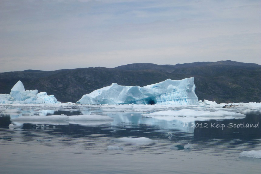
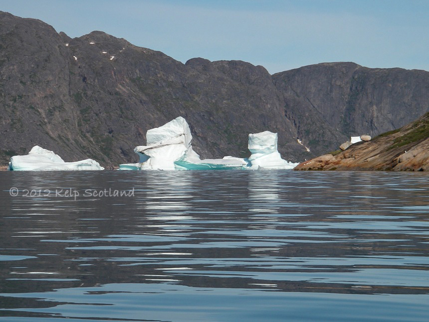
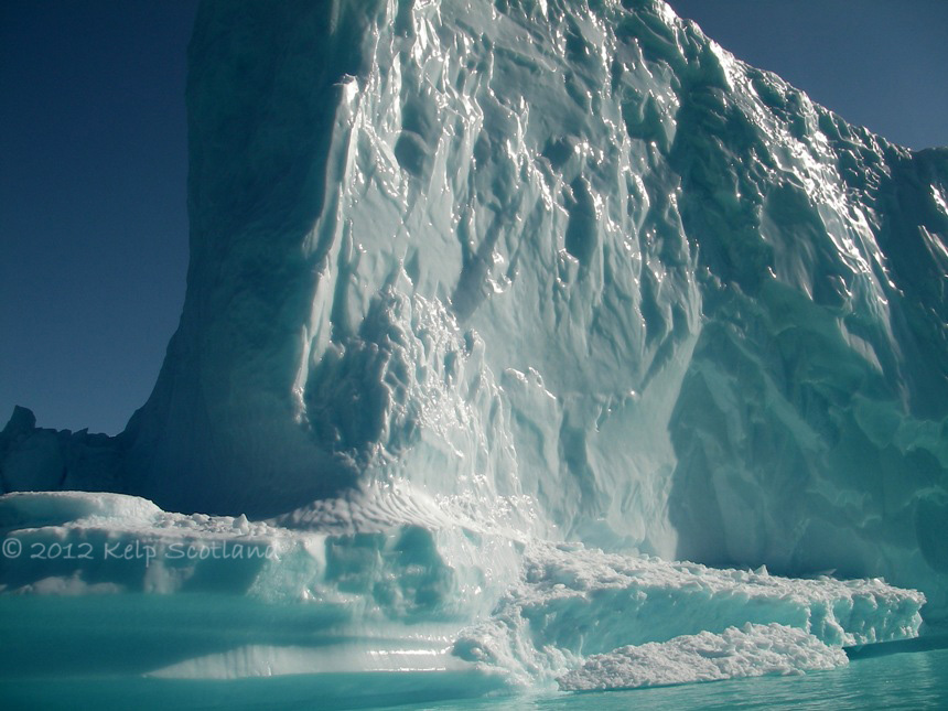
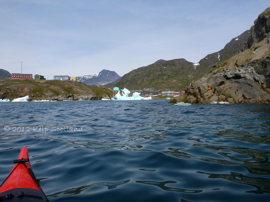
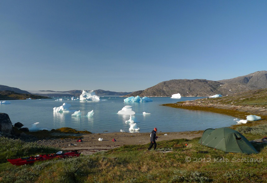
As we looked in direction Nuummiut, where we were looking to camp, all we could see was a myriad of bergs large and small set amongst a sea of brash. Could we find a way through to the coast across Narsaq Sound? The largest bergs were the size of a school. Many were akin to a two or three storey house. There was one very large flat-topped berg which had a network of tunnels eroded into the sides creating a series of columns and cloisters which reminded Debbie of the inside of a cathedral. Between the columns, the interior glowed in an iridescent glacier blue. The ice mix also contained hundreds of cars and refrigerators. We were doing our best to steer clear of the larger bergs in case they collapsed, exploded or rolled. We had soon learned that this could happen anytime without warning. Between the schools, houses, cars and refrigerators was a sea of brash through which it initially seemed straightforward to gently push our way through. There were many that resembled table tops or stools, sometimes with sculpted legs of ice. We soon discovered that even lumps as small as concrete building blocks were stubbornly resistant to being moved when nudged by the bow of a kayak.
When we had passed through Narsaq Sound on the outward journey 10 days earlier the berg-scape was very different. Whilst there had been as many large bergs, the sea had generally been relatively clear of ice. The warm weather had seemed to accelerate the collapse, and break-up of many bergs, creating a sea of brash. The Fjord Wind and tide seemed to have shepherded much of the ice to the western end of Narsaq Sound, exactly where we were looking to camp.

Life in the Freezer Isle, Nuummiut, Narsap Ikerasaa (Narsaq Sound)
Debbie and I were on a vacation expedition to South Greenland. We flew from Scotland to Narsarsuaq via Iceland. We had arranged kayak hire to paddle for 16 days on a self-guided exploration. Whilst the icecap is a straightforward day walk from Narsarsuaq, we chose to work our way to the icecap by kayak exploring as we travelled. We hired sea kayaks from Blue Ice Explorer in Narsarsuaq, a brand new Prijon Seayak LV for Debbie and a Prijon Kodiak for me. From Narsarsuaq, we paddled down Tunulliarfik (Erik’s Fjord); through Narsap Saava (Narsaq Sound); crossed Ikersuaq (Bredefjord); and explored Kangerlua, Maniitsup Tunuaq and Qalerallit Imaa; before crossing Ikersuaq (Bredefjord) to Tuttutooq and paddling back to Narsarsuaq.
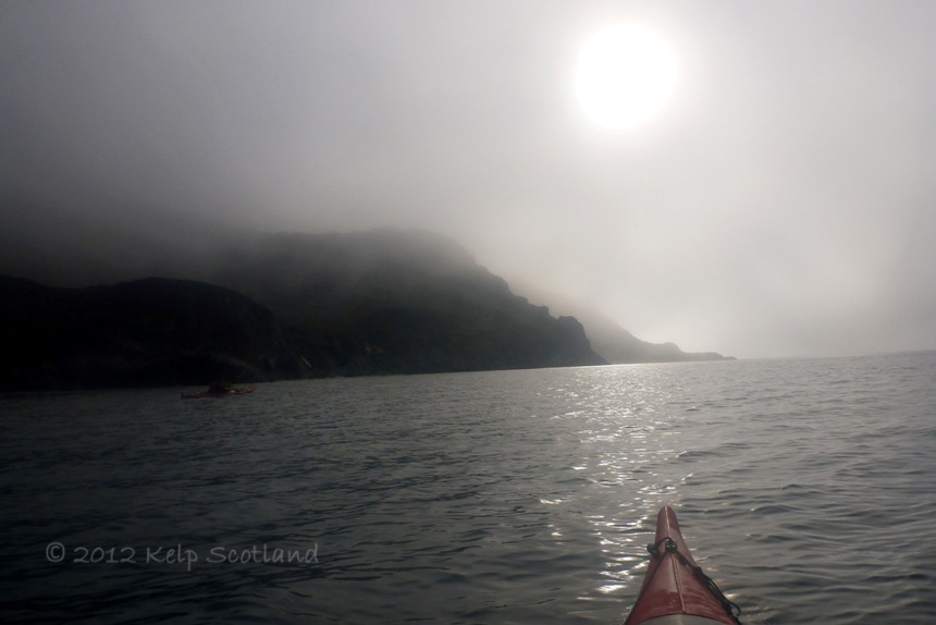
As we packed our kayaks in Narsarsuaq harbour, there was a lot of excited activity. Natalia from Blue Ice Explorer, who made all our kayak hire arrangements work like clockwork, explained that it was Greenland’s National Day which was a day of celebration, where anyone who could, took to the water to hunt seals. She warned us that we would hear gunshots but shouldn’t worry. The Danish captain of a large red freight ship came across to find out about our plans and show us an up-to-date satellite image of the ice clogged Narsaq Sound. As we paddled out the harbour a small crowd of locals were calling and cheering. We were inadvertently celebrating their culture.
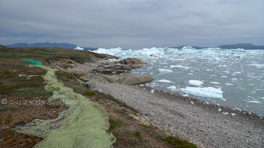
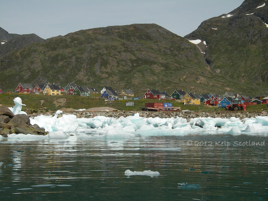
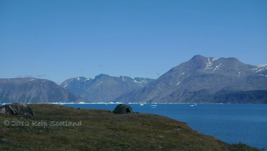
Nuummiut, Narsap Ikerasaa (Narsaq Sound)
Nuummiut, Narsap Ikerasaa (Narsaq Sound)

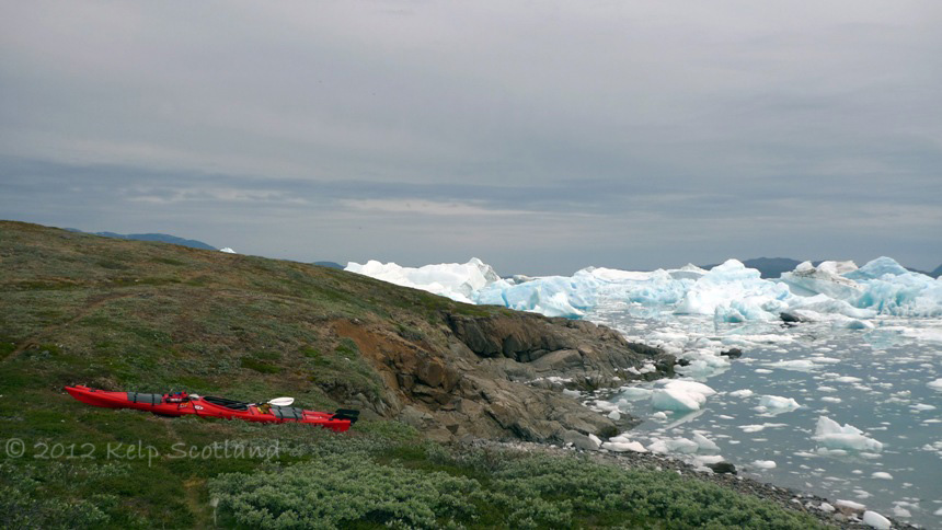
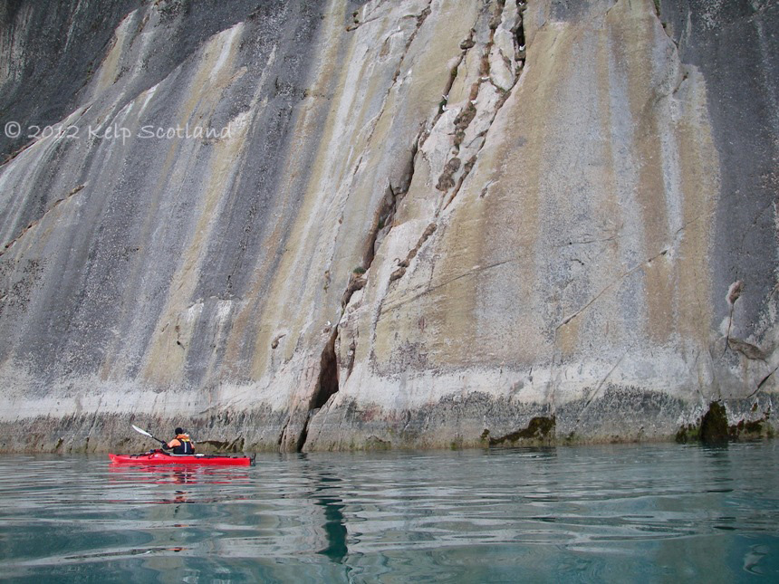
Crossing Ikersuaq (Bredefjord);
Crossing Ikersuaq (Bredefjord);
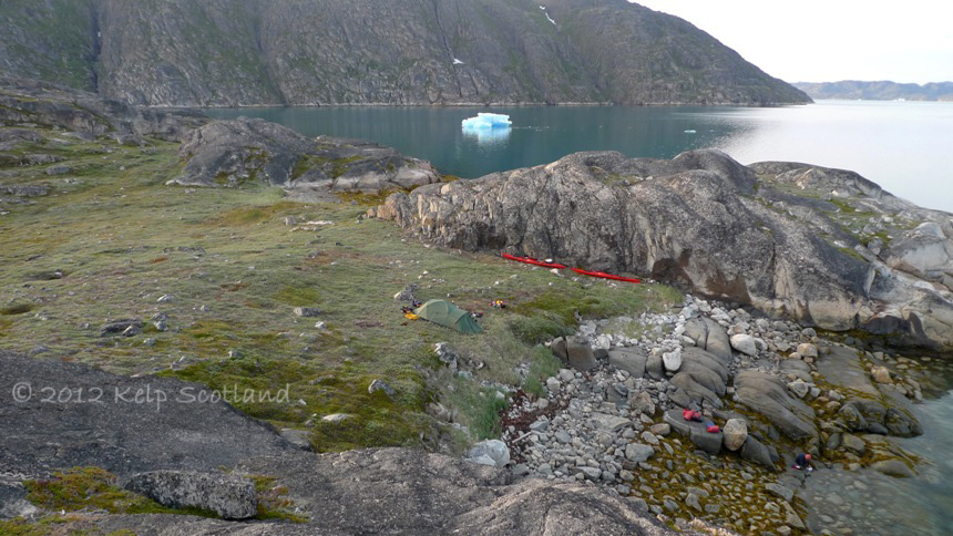
Landing at Nuummiut, Narsap Ikerasaa (Narsaq Sound)
Collapsed Cathedral, Ikersuaq (Bredefjord);

Narsap Ikerasaa (Narsaq Sound)


Packing at Narsarsuaq harbour
Working with the Weather
The weather patterns in Greenland are can sometimes be described in ways which are difficult to understand, particularly because of the casual inter-changeable terminology used. Having begun to understand the different weather patterns, we realised that some used the term foehn wind to describe what seemed to be fjord wind.
Fjord Winds develop when the sun warms the rocky mountain-sides in the upper fjords. The air rises and convection draws air along the fjords, typically from the south west. These thermal winds are essentially similar to “sea breezes” which are common in both Scotland and Alaska. If the day starts sunny and clear, then, in our experience, the Fjord Winds will come earlier and stronger. On a sunny warm day, the wind commonly increased from a force 2 to a force 4 in a short space of time around noon. Where fjord width is restricted such in Tunulliarfik (Erik’s Fjord) at Karra north of Nuugaarsuk (Narsaq Point), the Fjord Wind can potentially build to a force 5 by late afternoon. The sea state built steadily as the afternoon progressed. If however the morning was cloudy or misty, the process may start a few hours later or almost not at all, with the resulting Fjord Wind being less strong. In our trip, we had a period of relatively stable high pressure with cloudless skies for much of the trip. We regularly awoke at 4am and were on the water by 7am, which enabled us to have perfect paddling conditions. We did our best to camp in areas exposed to the Fjord Wind to keep the insects at bay.
Next to glaciers and the icecap, there was commonly a cold wind coming from the ice. These glacial winds are again thermal as they are a consequence of the temperature difference between the air over the ice and elsewhere, but can blow in the opposite direction to Fjord Winds for perhaps a few kilometres from the ice. These winds did not affect our paddling. Disconcertedly there were fjords west of Brede Fjord where glacial wind and Fjord Wind blew in opposite directions in different parts of the fjord.
The possibility of getting Foehn Winds concentrated our minds. Some who had been to South Greenland were of the opinion that paddlers could not forecast the arrival of a Foehn event. This both concerned and intrigued Debbie, whom I have come to rely upon for weather forecasting in remote areas; using her trusty digital barometer and her knowledge of clouds and weather patterns. The clearest account which we have discovered of what a Foehn Wind is can be found on the back of the Saga 1:100k topographic maps:
“Foehn is a dry and warm wind. It arises from a high pressure areaeast or north-east of Greenland from where the wind blows over the sea and crosses the inland ice towards a low pressure area west of Greenland. The wind comes down from the mountains as a warm, dry and often very intense wind from the south-east. The foehn can be recognised by black/blue lens shaped clouds over the inland ice and the fall in barometric pressure. The temperature on the west coast rises at the same time as the foehn breaks through with great intensity. The foehn can last 1-2 days and can occur several times during the same month. Only very few tents can stand the pressure of a foehn storm; therefore we recommend that you dismantle the tent and seek shelter behind big and heavy rocks”.
With this knowledge, Debbie studied weather records and we deduced the following chronology of events which may lead to a Fohn event:
- High pressure which moves north-east;
- This allows fronts associated with low pressure to the south west to come in.
- The weather becomes rainy and mild (even at night), with the wind becoming north-east or east.
- The weather becomes dry, but the north or north-east wind direction persists.
- Lenticular clouds appear above the icecap.
- That evening, and through the night, the wind steadily increases as the Foehn breaks through.
Whilst the research seemed to suggest a level of predictability in pattern, we were by no means fully confident in our ability to predict a Foehn event should one occur. During our trip the barometric pressure dropped by up to 9 millebars over a 12 hour period. We were watching for signs that the high pressure was moving north-eastwards. Pressure however rose again, indicating that the high pressure area was staying over us. The temperature was still dropping to 4 degrees Celsius each night. (Debbie’s barometer spent each night outside the tent). Towards the end of our trip we could see weather fronts approaching from the south-west. These eventually gave us wet warm weather for the last two days of our trip after two weeks of blue skies and daytime temperatures of 23 degrees Celsius. We did not have a Foehn event during our trip, however on our last day we heard, on the VHF, warnings of 15m/s winds (29 knots or Force 7) from the north-east further to the north at Natorlak. When we flew out of Narsarsuaq on the Saturday it was dry and clear. A Foehn Wind occurred on the Monday. Not having experienced a Foehn Wind clearly helped our trip go smoothly. However it became apparent that Debbie, as a member of the Cloud Appreciation Society, was disappointed not to have seen the full process unfold and in particular view the lenticular clouds.
Fjord Wind at Karra, Tunulliarfik (Erik’s Fjord) with Killavaat (Redekkammen) range in background
Karra, Tunulliarfik (Erik’s Fjord)

Approaching front, Tunulliarfik (Erik’s Fjord)

Misty Start, Tunulliarfik (Erik’s Fjord)
Morning mist, Tunulliarfik (Erik’s Fjord)

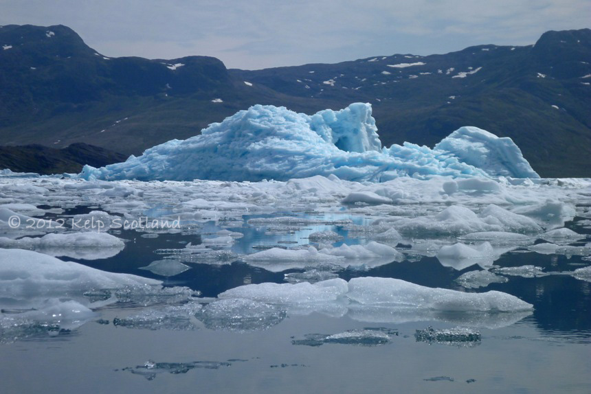
Blue Ice Fingers, Nuummiut, Narsap Ikerasaa (Narsaq Sound)
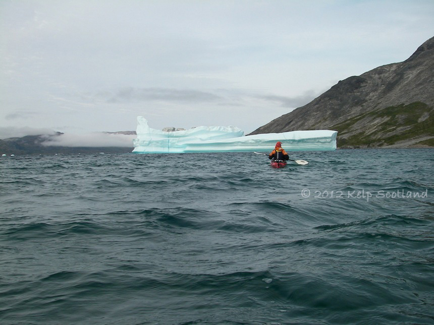
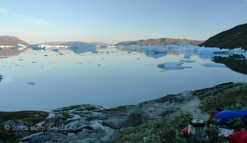
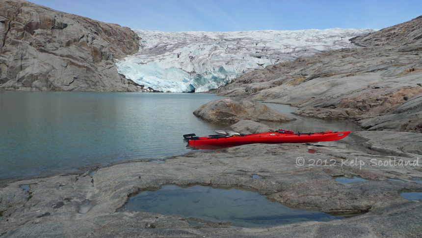
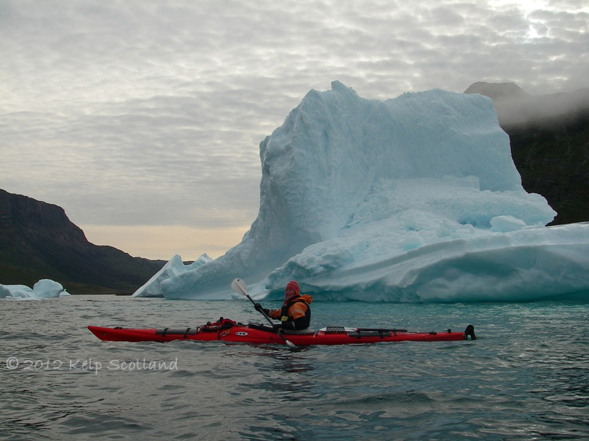
Living with Icebergs
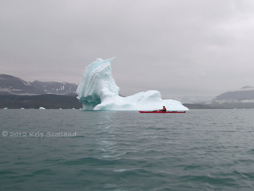
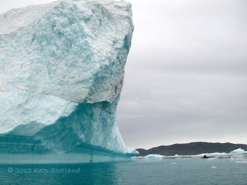
Greenland is a special place to paddle. One of the big things that make it so special and different is icebergs. Like fishes in the sea, icebergs are not found everywhere in equal numbers. They move up and down the fjords and sounds with the tide and the wind. Sometimes their movement is imperceptible, but then after a few hours in camp, you realize that the view is not the same as when you arrived. It is only in winter when the sea freezes do icebergs become a resident feature. Everyone knows that nine tenths of an iceberg is under water, which I guess explains why they seem reluctant to move in a hurry with the wind and the waves. Waves crash against them like rocks and there can be a surprising amount of shelter from wind and waves amongst them. The blue icebergs at the confluence of Tunulliarfik (Erik’s Fjord) and Qooqqut can sometimes seem stuck in limbo where tide and wind collide, moving backwards and then forwards reflecting the struggle for supremacy between the elements. For others, their fate is to be pushed by the fjord wind into bays where they crush together and become grounded; groaning and rumbling as the tide rises and falls.
Debbie wrote on a forum:
“Kayaking amongst icebergs creates an excited, childlike gleeful state in me and is one of those amazing life experiences. Icebergs are not simply just visually beautiful floating sculptures – they are noisy and alive and constantly change, sometimes right before your eyes.
They crackle, hiss, pop like gunshot, or powerfully explode as if lit with dynamite, spewing their sharp, icy shrapnel for many metres. As they melt, they become top heavy, unstable and roll slowly, languidly, groaning and creaking from their immense weight and size. Occasionally they collapse dramatically with a thunderous roar eventually settling like redundant battleships.
Startling echoes can be heard while lying in your tent in the otherwise silent twilight that is the night.
Some are a vivid electric blue, glowing on a dull day as if lit from within. Even small, clear irregular ice globes are heavy and bang like lumps of concrete against your hull. There are ice spires, ice caves, ice arches and even small waterfalls which descend off the sides of gigantic floating mini-mountains. Some look like animals or people. The Queen, a pussycat, a goat, and even Ronald Reagan”.
The Queen and the Pussycat, Nuulussuaq
The Goat, Tunulliarfik (Erik’s Fjord)

Ronald Reagan, Maniitsup Tunua
As we picked our way through the ice a small aluminium power boat with an outboard engine seemed to be slowly making his way through the ice roughly parallel with us a few hundred yards away. He stopped his engine and we supposed that he was hunting seals. We left him behind. We found a suitable rocky beach to land at and had just erected the tent when the boat appeared again. He gave us the now common reserved wave, but pointed beyond the nearby promontory.
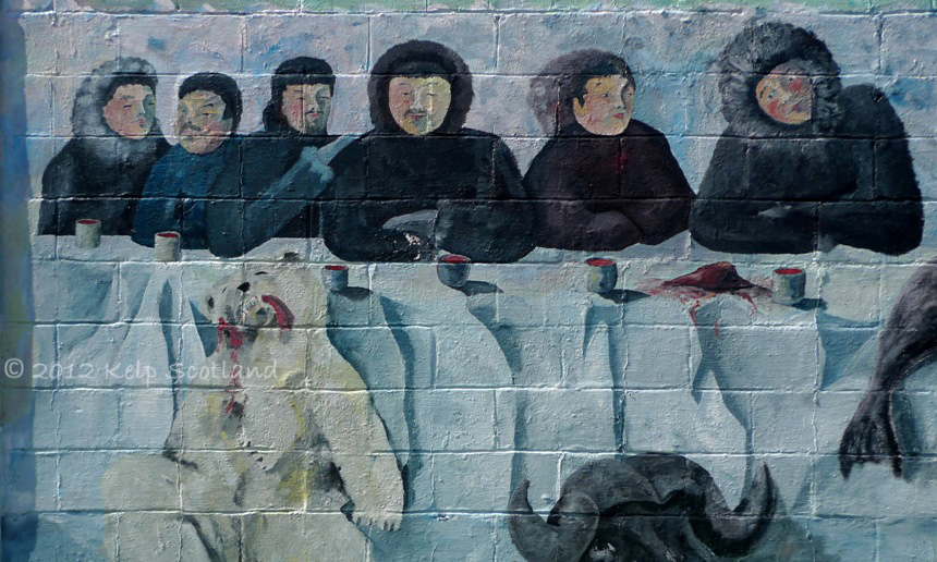
A few minutes later, he appeared over the top of a knoll. He was Inuit and wearing a dirty old mid blue Bergaus goretex jacket with a warm smile. His facial hair was actually fairly long but could be easily missed. His English was very limited, but it turned out that he had a building over the knoll constructed from flotsam which he was keen to show us. In the building, he dried his filleted fish on old fishing nets slung like hammocks. He was keenly proud to show this and the adjacent vegetable garden. He said that he could read and write English better than he could speak it. A pen and paper showed that much of our communication difficulties were down to differences in pronunciation. My “choolick” (tuliq) should have been pronounced “toolick”. He brought out two woven sacks to show us what he produced. One was stacked full of dried Cod. The other also contained fillet like shapes, but these were dark red in colour. He tried to tell us what it was. We thought he said “silde”, which we understood to be Herring, but it didn’t look like Herring. Debbie drew a picture of a seal, but it looked more like a whale, we all laughed.
He was 64 years of age and lived in Narsaq. He assured us that camping where we were was perfectly acceptable. There were long silences in the conversation, but afterwards Debbie assured me that this was culturally normal. He trolled for fish with a long line. He also had a rifle in his boat for seals. He had a fishbox mostly full of Atlantic Cod, but was excited to show us a couple of Arctic Char in the box. We couldn’t work out whether he wanted to sell them to us or not. In any event, I was determined that the first time I eat Arctic Char, it will have been caught by me. He was keen to show us from the knoll that the ice became much less closer to Narsaq. He was keen to discuss the ice and we think that he was telling us that “grunded” bergs are safe. As he talked about the sea, he became confident and he lost his nervous friendliness of earlier. There was clearly a level of cultural empathy with kayaks, but my lasting thought was that the Inuit people through time principally identify themselves as hunters rather than kayakers. This tradition is alive and well. Before he left for Narsaq, he invited us to use the “primus” in the building if needed.

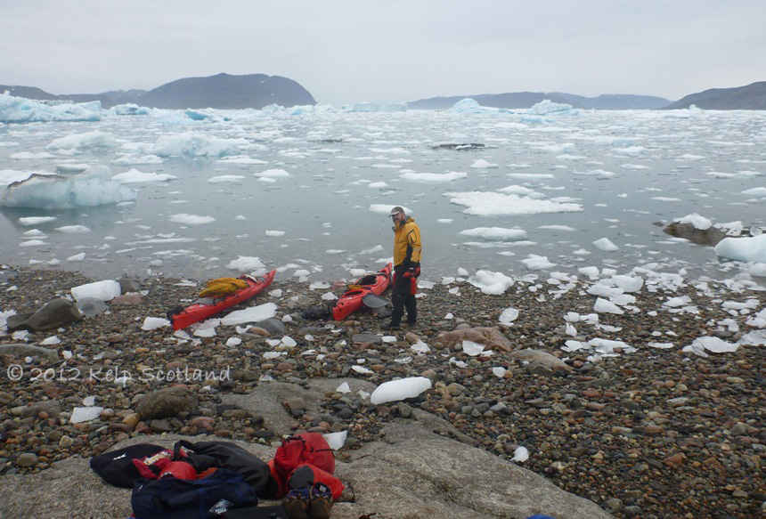
Big Berg, Kangerlua

Qaarsormiut, Narsaq

Misty Dawn, Maniitsup Tunua
Nuummiut, Narsap Ikerasaa (Narsaq Sound)
Glistening Berg, Kangerlua
Hunting for Arctic Char
I am not an experienced angler, but last year in Helgeland, Norway, I was pleasantly surprised at how easy it was to catch Cod by spinning from rocky promontories. Whilst touring, it made our meals more appealing and nutritious. In Greenland, Arctic Char spend most of the year in the rivers and freshwater lakes but in South Greenland they enter the fjords to feed from around late June to mid July. I was therefore hopeful of catching Atlantic Cod, Greenlandic Cod and especially Arctic Char.
Before our kayak hire started, we had a day in Narsarsuaq to buy food and fuel for our trip. Having completed this task and having had a walk up a small hill locally (Signal Hill), we set off looking for a place to catch our evening meal. Ahead of us, coming towards us, was an Englishman with a fishing rod, accompanied by a pair of Inuit youths who couldn’t stop laughing. They seemed to have developed a rapport, despite the lack of a common language. The Englishman was however distraught: The handle of his fishing reel had snapped off on what appeared to be his first attempt to fish. His new-found friends, found this hilarious. The fact that apparently an Inuit woman nearby had apparently caught four good sized “Trout” (more likely to be Arctic Char) added salt to his wounds. I caught a couple of pan-sized Atlantic Cod and my first Arctic Char which was too small to keep.
I would only be fishing for food and therefore only fished when there were both somewhere suitable near camp and we had sufficient time before our evening meal. Debbie showed herself to be a reliable mussel gatherer when the tides were right and fed us several times during our trip. My fishing was less predictable. I had been fishing in the Fjord Wind and my “hunting” was less reliable than Debbie’s “gathering”. As the trip progressed, I became increasingly eager to catch an Arctic Char for the pan. I had “landed” a large one, but as I pulled it onto the rock slabs, in my excitement, I mistakenly allowed the line to slacken and it unhooked itself and thrashed itself into the sea before I could get to it. I was devastated.
The next day, after our paddle, Debbie (licking her lips) offered to be on fish pouncing duty. Yes, every inept angler should have one. The wind was light and the sea clear. The morning mist had delayed and lessened the Fjord Wind. A short walk from camp took me to a basalt promontory with deep water. After a few casts, I could see Char following my lure to shore, and became excited. We caught three in under an hour, each time I hauled them high onto flat rocks and Debbie pounced on them. We gorged ourselves on Arctic Char that evening. The catch fed us for two days.

The Proud Hunter

Short Horned Sculpin
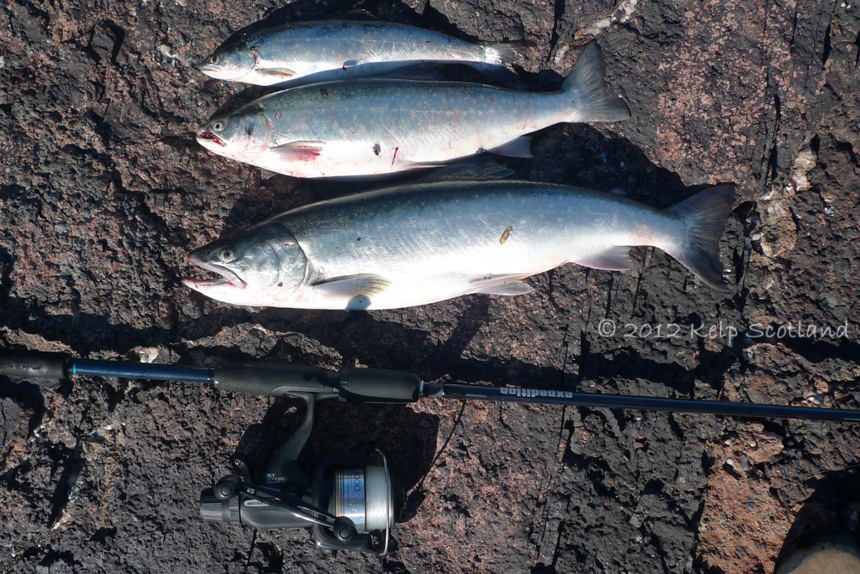
Arctic Char
Narsarsuaq School
Narsarsuaq School

Narsarsuaq from Signal Hill

Kuusuup Sermia from Signal Hill, Narsarsuaq
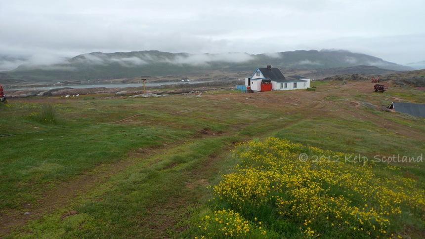
An Expedition to the Supermarket
The supermarket in Narsaq is much bigger than the one in Narsarsuaq. It is also situated close to the shore so, if you manage to land in the right inlet, it will be within a couple of hundred metres away. The most easterly bay is the harbour used by big ferries, fishing boats, freight ships and commercial sightseeing boats. Further west is a narrow inlet marked by an island in its mouth. Deep inside is a marina, with the supermarket at the head of the inlet. Positive identification is confirmed by swarms of speedboats racing in and out at full speed.

Narsaq

Commercial Harbour, Narsaq
Supermarket Inlet, Narsaq
Narsaq

Narsaq
In Touch with the Land
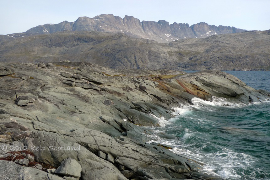
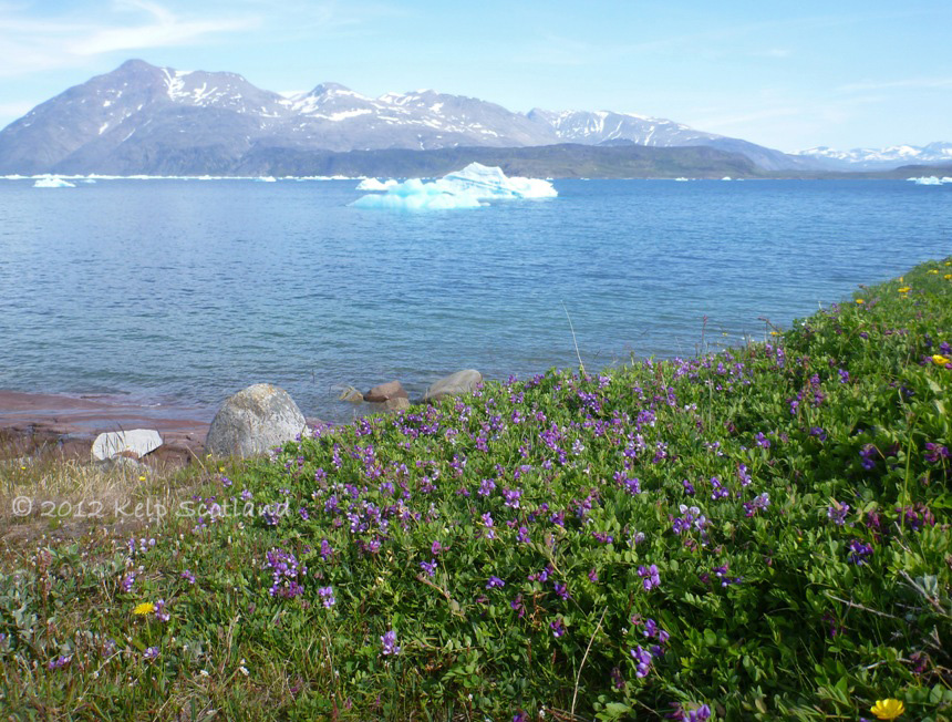
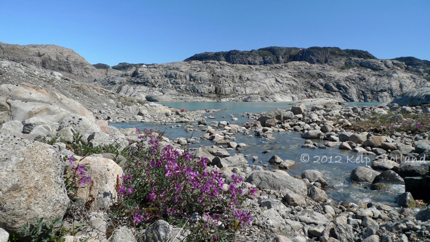
We often camped on acid heath, where large carpets of Crowberry covered the ground with prostrate Juniper, Willow, Dwarf Birch, Bilberry and Harebells also being commonplace. A Dwarf Birch with a stem diameter of 2 inches could be as old as 100 years. It had been unseasonably dry and the underlying peat was powder dry with the grasses dried and brown. We had to take great care where we set up our stove to avoid setting South Greenland alight. Sometimes there was good tent pegging, elsewhere, bedrock or rocks were just below the surface. Relatively close to glaciers there were no soils or vegetation, but the glacial gravels and sands had often been “sorted” by the glacier and consolidated and would probably have provided better than expected pegging if we had camped in these areas. Much of where we paddled was acidic volcanic rocks overlaid upon base rich schist and sandstone. Where the latter formed the coast, there were sometimes swathes of Willow Herb and Sea Pea.
In areas of sheep farming it was sometimes grassier. Sheep farming areas also had the curious (but very welcome) benefit of having a dramatically reduced or non-existent mosquito population. This is believed to be a result of the mosquito’s reluctance to lay eggs in water where sheep have been.
Ironically, the rockiest surface we camped on was outside the hostel in Narsarsuaq at the start and end of our trip. We did however have the use of the hostel facilities. At the end of our trip, the hostel was occupied by several Greenlandic families who seemed to be on holiday together. During the evening everyone sought sanctuary from the mosquitoes in the hostel lounge. The girls had collected harebells which were growing prolifically around the hostel to provide flowers for each table. As the sun went down and it cooled off, mosquito numbers reduced; and the kids were ushered outside to play baseball. The first few outside scurried around in the bushes and emerged with branches with which to demarcate bases. One teenage girl seemed less than keen and following firm persuasion by her parents, stomped outside wearing her head net in protest. She was the only one wearing one.
The next morning, as we packed for our flight, the Greenlandic teenagers were going into town. The girls were putting on their makeup and the boys putting gel in their hair. Debbie found it bemusing that after they went to all this trouble they then put head nets on before exiting. Most of the head nets were not any better than the grubby military green ones we used. One of the boys had a head net which seemed to be bigger and looser to accommodate bigger hair. It was not tubular in shape like our head nets, but rather it had a cut similar to a flat paper bag. Consequently it stuck up above the head and looked almost as if it had miniature bear ears. Fashion is different in the Arctic: The in-flight magazine for Icelandair advertises designer woman’s dresses made of seal skin trimmed with fox fur.
Early Breakfast, Narsap Ikerasaa (Narsaq Sound)
Camping amongst Sea Pea, Buttercups and Dandelions, Tunulliarfik (Erik’s Fjord)
Morning Packing, Maniitsup Tunua
Naajaat Sermiat

Niviarsiaq (Broad Leaved Wilow-Herb), near Naajaat Sermiat
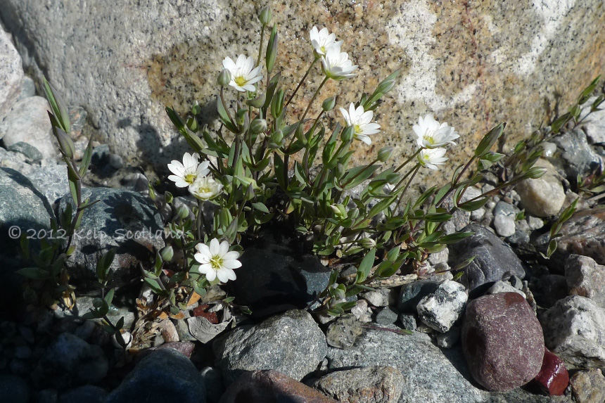
Mouse-Ear
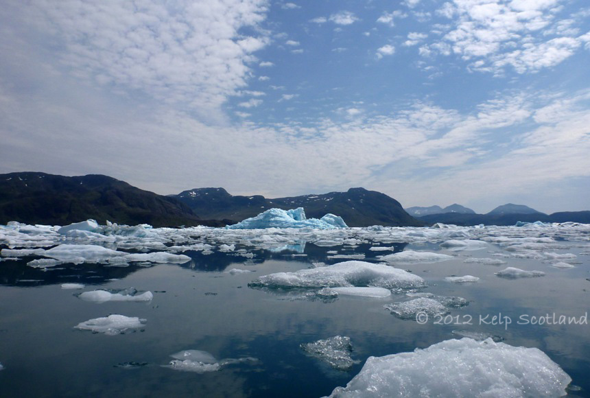
Tunulliarfik (Erik’s Fjord)
Qalerallit Imaa
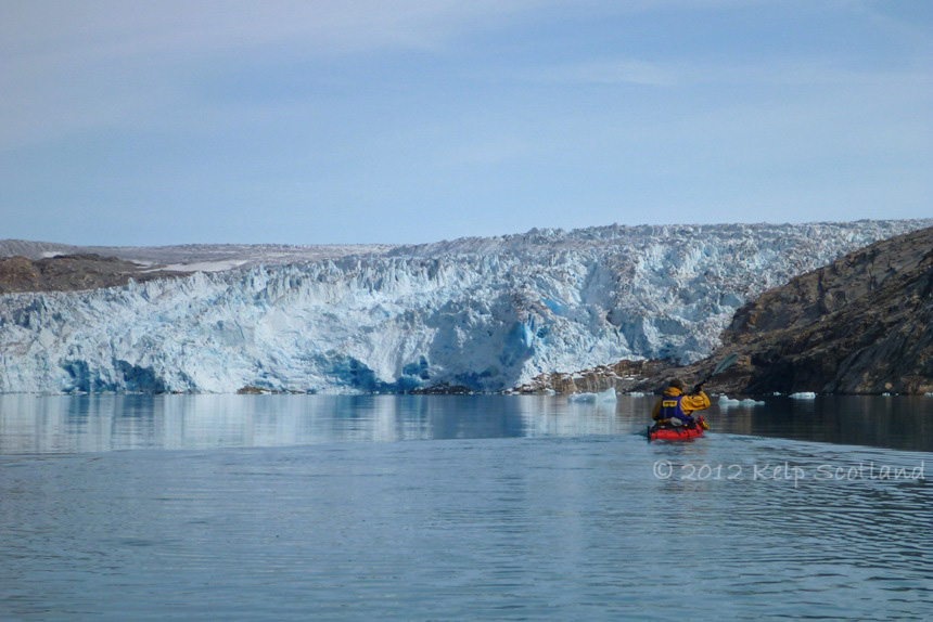
Qalerallit Sermia
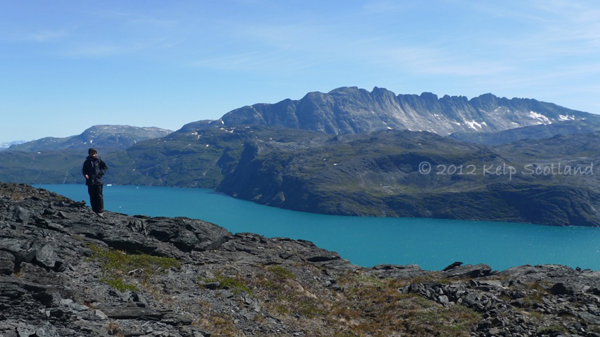
Killavaat (Redekkammen) range from Nunasarnaq (Strygejernet),Karra, Tunulliarfik (Erik’s Fjord)
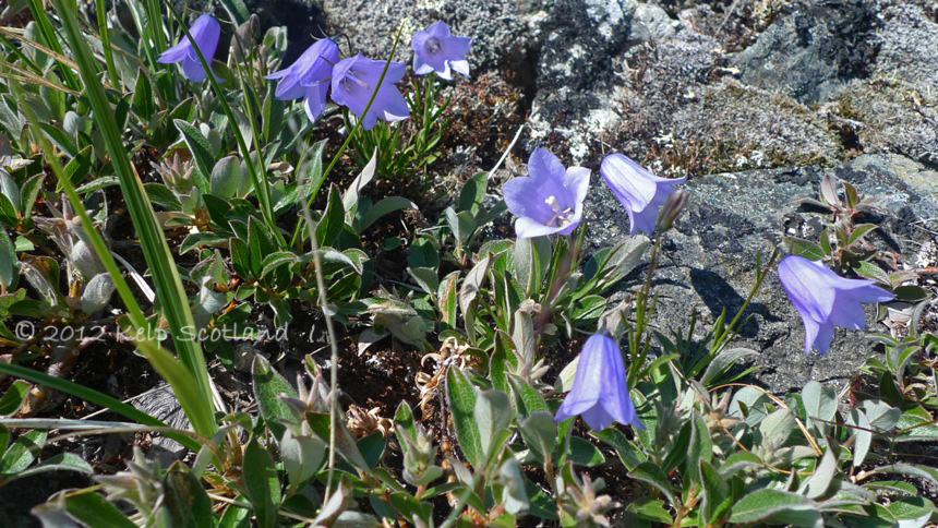
Harebells
South of Tartuusat, Tunulliarfik (Erik’s Fjord)
Tasiusaq, Sermilik (Isafjord)
In the Footsteps of the Vikings
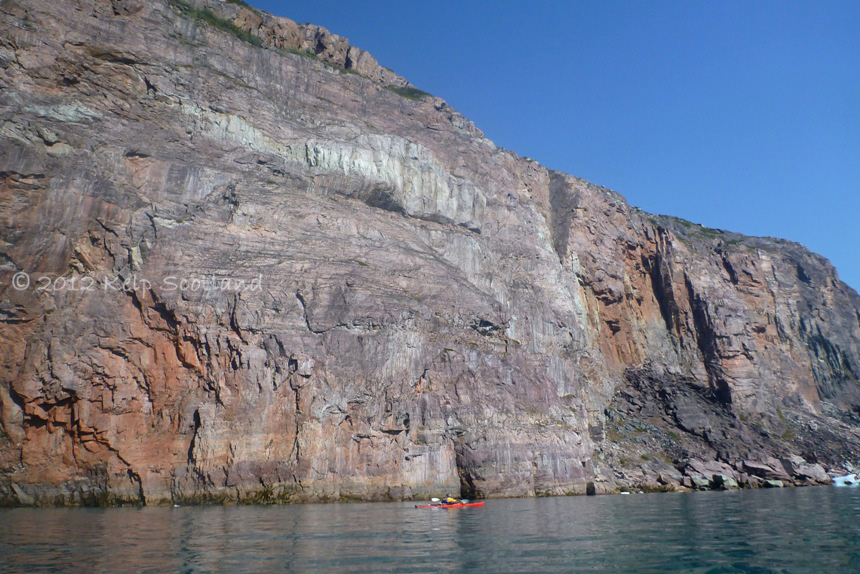
West of Ikersuaq (Bredefjord), we were beyond the area covered by 1:100k maps and were relying upon the 1:250k maps. Trip planning for these areas was a much more generalised affair, with our confidence level in our notional potential camp-spots being much lower. On the map, the hills appeared to pewter out at the southern end of Akulloruseq and we were therefore hopeful of finding a suitable small cove with the benefits of Fjord Wind. We were travelling along the peninsula. The shore consisted of steep rock slabs with only occasional boulder filled coves which didn’t look easy to land on. The other side of the fjord was a continuous towering basalt cliff. As we reached the end of the peninsula, the shore became less steep and small rocky coves could be found between the schist promontories. I was determined to find a cove with reliable fjord wind insect control, so Debbie humoured me until we found our perfect cove. Upon landing, we discovered that the other landing opportunities which I had declined were visible across the tip of the peninsula a few hundred metres away. We did however have the best spot and enjoyed a steady breeze all evening. Between and behind the almost white rounded mounds of schist which formed the promontories were a scattering of Norse ruins and small circular stone walls where the ground was suitable. Between the schist mounds were three small rocky coves, all accessing the same settlement. In the centre was what appeared to be a sizeable man-made loch. (In Scotland such an area would have been bog rather than standing fresh water). It looked as if those who once lived here had dug it out as a fresh water storage area.
That night I lay in the tent drifting off to sleep. As the tide rose and the breeze died, I thought I could hear the sound of wooden boats being beached on the rocky shore of the cove. I listened carefully; I could hear distant conversations and laughter. It seemed that the Norse residents were still there. The next morning there was a small berg rumbling around, stuck against some rock slabs close to our beach. The Fjord Wind had disappeared. At 5am and 4 degrees Celsius, it was too cold for insects. We ate breakfast sitting on a large smooth rock and talked about who may have sat there a thousand years before and what they would have been wearing; and whether the curved walls nearby would have been animal enclosures or designed to keep free range animals out of areas for growing crops.
The Norse established two colonies during the 10th century; both of which were in South Greenland. We were touring amongst the Eastern Colony, established by Eric the Red after he discovered Greenland in 982 AD. It soon became apparent that it was common that places we chose to camp had ruins nearby. Law requires that one does not camp closer than 20 metres from ruins. I guess that much of what we were looking for was also important to earlier inhabitants. The eastern colony, which at its peak comprised 200 farms, became depopulated around 1450 AD. Some historians have suggested that this was linked to the climate becoming colder and wetter around that time, which may have made it less suitable for the pastoral farming system of the Norse.
Ironically, the best summer weather we experienced during 2012 was in South Greenland not Scotland. I couldn’t help but ponder on the contrasting histories of Greenland and Scotland. A decline in pastoral farming lead to the end of the Viking civilisation in Greenland. In Scotland, it was the expansion of pastoral farming which lead to the depopulation of the highlands and islands through the Highland Clearances.
Akulloruseq

Akulloruseq
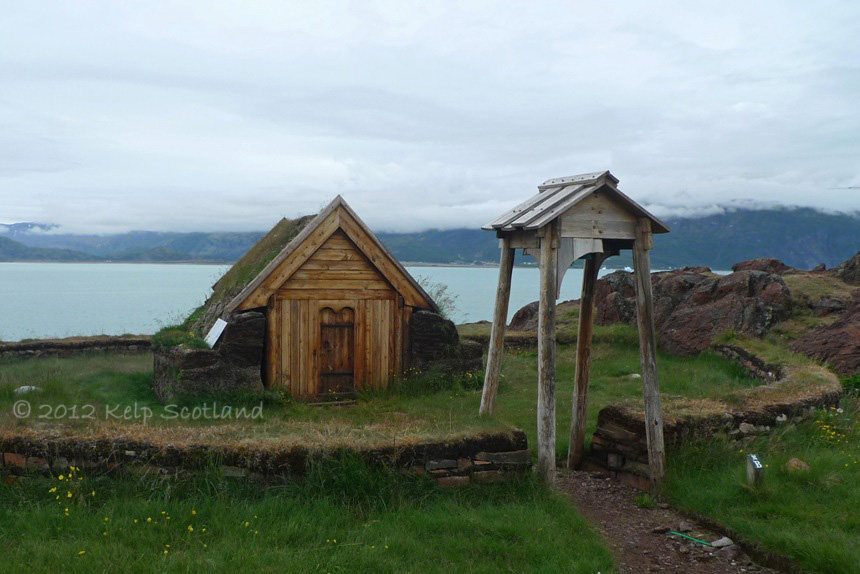
Replica Viking Chapel, Qassiarsuk (Brattahlid)
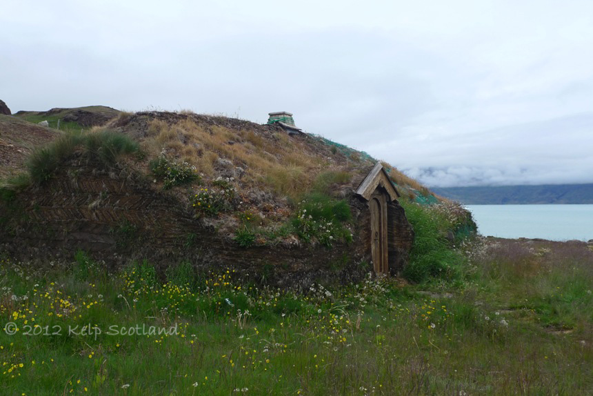
Replica Viking Longhouse, Qassiarsuk (Brattahlid)

Kangerlua

Viking Pasture, Kangerlua

4 Responses to “South Greenland 2012”
Great pictures of a great trip. The dangers and difficulties were apparent. I would be interested to know how far you got in a day? And how far you covered overall?
I also learnt of “the mosquito’s reluctance to lay eggs in water where sheep have been”. Hope I never need to use this information.
btw, is it possible a rampant spellchecker changed “flotsam” into “float some”?
LikeLike
Many thanks. We would typically expect to cover around 20km per day. It can however vary a lot depending upon conditions; cliffs & crossings; camping oportunities and the need to catch flights. In South Greenland we covered around 260km.
LikeLike
I think that this is a fantastic adventure that you’re sharing with us who might never been able to do what you has done. This is a sort of, reading travelling and with pictures you give to us. I’m amazed and very thankful. Thomas Granath
LikeLike
Thanks Thomas, glad you enjoyed it. 😀
Stewart
LikeLike